Denton County hazard data

Denton, TX Disaster Risk

FEMA rates relative hail risk for Denton County as very high and reports FEMA annualized frequency of 9.981 per year for the area.

Tied #10 of 53 covered Texas cities for hail risk β†’FEMA relative score 99.9/100 Β· county scale

FEMA summary

Denton's hail risk is very high at county scale.

FEMA's profile for Denton County reports FEMA annualized frequency of 9.981 per year for hail. FEMA's relative risk rating for the area is very high; the annualized frequency is a separate measure.

Hazard metrics cover FEMA county-equivalent geographies rather than individual addresses or parcels. Use local or state hazard maps before making a property, insurance, retrofit, or evacuation decision.

FEMA annualized frequency

9.981 per year

View hazard details ↓
FEMA area population
906,057
Data geography
County equivalent
FEMA relative score
99.9/100
FEMA source
v1.19.0

Explore hazards

Select a hazard to inspect FEMA's figures for Denton County.

FEMA NRI profile

Hail

Very High

FEMA combines its area-wide loss estimate and community data in this relative rating. Event frequency appears separately below.

Relative FEMA score

99.9/100

FEMA annualized frequency
9.981 per year
FEMA area loss estimate
$92M
Recorded events
340

How to read this

Occurrence thresholds vary by hazard. The FEMA methodology defines the value for each hazard.

The area loss estimate combines FEMA's modeled losses to buildings, population, and agriculture across Denton County. It is not an estimate for a home or address.

City risk summary

Hail risk in Denton

For Denton, FEMA rates hail risk for Denton County as very high, with a relative score of 99.9/100. The next highest relative scores are tornado at 99.8/100 and heat wave at 98.5/100.

Using FEMA data for Denton County, Denton is tied #10 among 53 covered Texas entries for hail risk; 2 entries share that score. Lewisville is about 15 straight-line miles from the Denton map point and uses the same FEMA geography.

What to check for hail

  • βœ“Check the roof’s age, material, and record of earlier impact damage.
  • βœ“Review skylights, exterior equipment, trees, and covered vehicle parking.
  • βœ“Compare the wind-and-hail deductible with the roof settlement terms in the policy.

Household preparation

Official guidance β†—

For homeowners and movers

  • βœ“Confirm the exact hazard using official local maps before making property or insurance decisions.
  • βœ“Review policy exclusions, deductibles, and temporary-living coverage with a licensed professional.
  • βœ“Keep inspections, inventories, and critical documents in a secure location you can access after an emergency.

Preparedness actions

  • βœ“Know how local officials issue warnings and evacuation instructions.
  • βœ“Maintain water, food, lighting, medications, and communications for several days.
  • βœ“Create a household communication plan and practice it before an emergency.
Build your household checklist
Brownstone apartment buildings
Urban Survival

The Apartment Fortress

Living in Denton? Learn how to handle water storage, sanitation, and security in a small space.

Read the Guide β†’

Where this profile applies

The map shows Denton. All FEMA figures on this page cover Denton County.

Loading map…
City
Denton, TX
FEMA data area
Denton County
County FIPS
48121

Questions about disaster risk in Denton

The FEMA figures cover Denton County. Address-level conditions require local maps, building records, and property details.

How much hail risk does Denton, TX have?

FEMA rates relative hail risk for Denton County as very high. Its FEMA annualized frequency is 9.981 per year. Damage at a specific address also depends on the building, soil, elevation, and exact hazard zone.


Where does Denton rank for hail risk in Texas?

Among 53 Texas cities covered by this directory, Denton is Tied #10 for relative hail risk based on FEMA's score for Denton County. 2 covered cities share this rank because they use the same FEMA geography. Homes within Denton can have different soil, elevation, construction, and hazard-zone conditions.

Which natural hazards rank highest around Denton?

In FEMA's data for Denton County, the highest relative ratings are Hail (Very High), Tornado (Very High), and Heat Wave (Relatively High). FEMA uses estimated losses and community data along with event frequency when assigning these ratings.

Are the disaster-risk numbers for Denton or Denton County?

The hazard numbers cover Denton County. For an individual home, check local fault, flood, fire, evacuation, and building records for the exact address.

Is Denton safe from natural disasters?

FEMA gives Denton County an overall relative risk rating of relatively high. Conditions at a specific home depend on its hazard zones, building type, maintenance, insurance, and access to evacuation routes and emergency services.

What should a household in Denton do first for hail preparedness?

Start with this step: Confirm the exact hazard using official local maps before making property or insurance decisions. Know how local officials issue warnings and evacuation instructions. Use Ready.gov Be Informed and local emergency guidance for a complete plan.

Nearby city comparisons

Distances are measured between city coordinates.

CityDistanceHail ratingRelative score
Lewisville, TX15 miVery High99.9
Frisco, TX19 miVery High99.8
Carrollton, TX21 miVery High100.0
Plano, TX26 miVery High99.8
Irving, TX27 miVery High100.0

Relevant preparedness gear

Limited to products tagged for hail or general preparedness.

Disclosure: As an Amazon Associate, this site may earn from qualifying purchases.

Leatherman Wave+ Multi-Tool

Tools

Leatherman Wave+ Multi-Tool

18 tools in one. Essential for turning off gas valves or making repairs.

View product
Anker PowerCore 10K

Power

Anker PowerCore 10K

Pocket-sized power to keep your phone alive for emergency calls.

View product
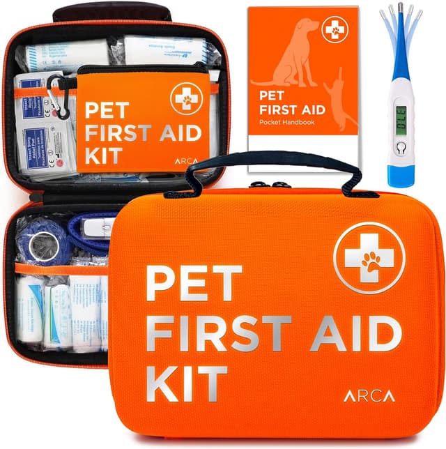
ARCA PET Cat & Dog First Aid Kit

Pets

ARCA PET Cat & Dog First Aid Kit

Comprehensive kit for pets. Includes muzzle, thermometer, and bandages.

View product

Data sources

Hazard metrics come from FEMA National Risk Index v1.19.0 (March 2023). City population and coordinates come from SimpleMaps US Cities Database. For current conditions, use official local maps, warnings, inspections, and professional advice.